YarnBomber.com
  • Home
  • About
    • Contact
    • Blog
  • Shop
    • Yarnbomber Gear
  • Projects
    • Pussyhat Yarnbomb
    • Dreamer >
      • Tucson Dreamers
    • Alien Campsite '15
    • Lizards Mouth '14
    • Seven Falls '14
    • Sasquatch '14
    • Saddlerock '13
    • Cold Spring '12
    • Guinness World Record Largest Crochet Granny Square
  • Press
  • Podcast
  • Hiking Guide
  • Bomb Squad
  • Untitled

Yarnbomber's guide to
Santa Barbara's
​Hiking Trails

Saddlerock Trail

2.2 miles roundtrip
799 feet elevation gain
​
By far, the shortest distance you can travel to get spectacular views and a feeling of accomplishment, but don't take it for granted. The final 1/4 mile is challenging.

Full details including directions to the trailhead, a trail map and dozens of photos taken along the way so you don't get lost, can be found by HERE.
Yarnbombers Hiking Guide Saddlerock Trail
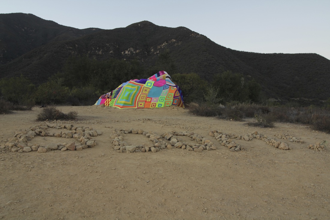
My Yarnbomb installation atop the Saddlerock Trail from 2013 for 9 days.
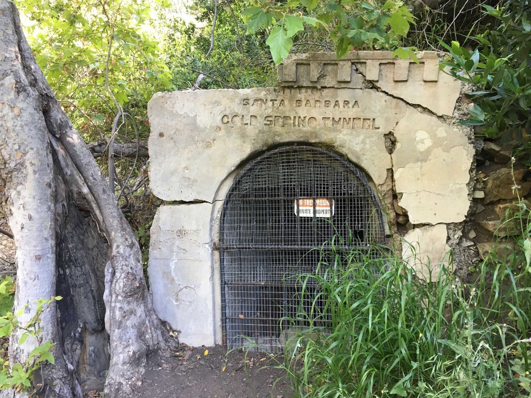
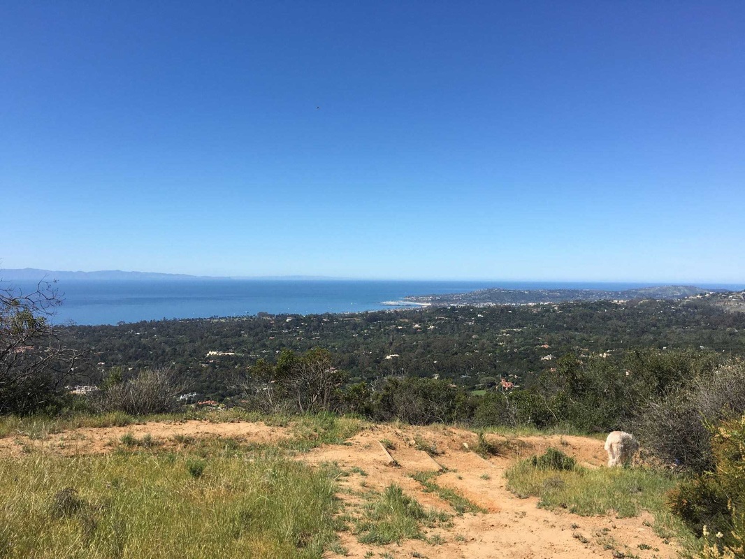
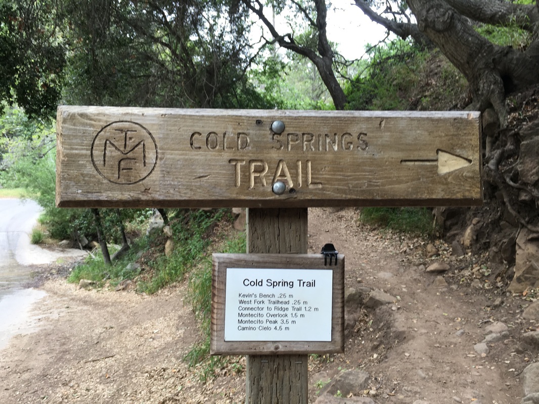
Cold Spring East to the Eucalyptus Tree

5.4 miles roundtrip
1,800 feet elevation gain
​
One of the most popular trails in the front country, and for good reason. It was the site of my very first yarnbomb installation.

Full details including directions to the trailhead, a trail map and dozens of photos taken along the way so you don't get lost, can be found by clicking HERE.
Yarnbombers Hiking Guide Yarnbombed Tree Cold Spring Trail
The eucalyptus tree yarnbombed in the Spring of 2014 for 9 days. (Photo: Susan Bell Photography)
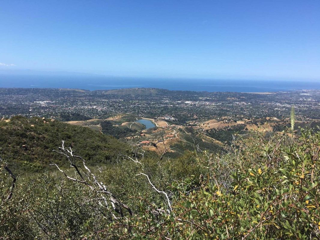
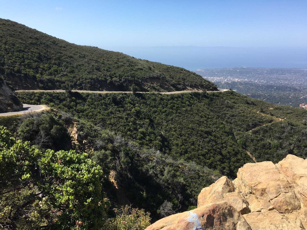
Cold Spring West to Gibraltar Road

4.6 miles roundtrip
1,171 feet elevation gain
​
Be sure to bring a hat and sunscreen. The first 1.25 miles are in the shade but the last mile offers no relief from the sun.

Full details including directions to the trailhead, a trail map and dozens of photos taken along the way so you don't get lost, can be found by clicking HERE.
Yarnbombers Hiking Guide Cold Spring West Gibraltar
Cold Spring Tunnel about 1 mile up from the trailhead.

Jesusita Trail to Inspiration Point

7.2 miles roundtrip
1,500 feet elevation gain
​
A beautiful, but challenging hike beginning at the water treatment plant near the top of Las Positas.

Full details including directions to the trailhead, a trail map and dozens of photos taken along the way so you don't get lost, can be found by HERE.
Yarnbombers Hiking Guide Jesusita Trail Inspiration Point
View from Inspiration Point looking down on the Water Treatment Plant at the Jesusita Trailhead.

Rattlesnake to Gibraltar Rock

5.7 miles roundtrip
1,850 feet elevation gain

This trail begins just above Skoffield Park and finishes at the popular climbing spot Gibraltar Rock along Gibraltar Road.
 
Full details including directions to the trailhead, a trail map and dozens of photos taken along the way so you don't get lost, can be found by HERE.
Yarnbombers Hiking Guide Gibraltar Rock
View from Gibraltar Rock, a favorite spot for local climbers.

MSG Triangle in Montecito

3.2 miles total
1,040 feet elevation gain

This hike begins on McMenemy, turns onto Saddlerock, uses the Edison Catway to pick up Girard before meeting up with McMenemy again. I call it the MSG Triangle because of the 3 trails it includes, but also because it reminds me of how I feel when I eat chinese food. You feel full tired while you're on it, but 10 minutes later you're ready for more. 
Yarnbombers Hiking Guide McMenemy Girard Trails in Montecito
View of Santa Barbara from where the Girard & McMenemy trails meet.
 
Full details incl directions to the trailhead, a trail map plus photos and waypoint notes so you don't get lost, can be found by clicking HERE.

Cold Spring East Short Hike

2.9 miles total
900 feet elevation gain

When you don't have time for a big hike, but want to get out there and break a sweat, this one is for you. No section is very challenging and you don't have to backtrack to get back to the trailhead, so every step offers something new for the explorer in you.
Yarnbombers Hiking Guide Cold Spring Trail
Cold Spring Trailhead
 
Full details incl directions to the trailhead, a trail map plus photos and waypoint notes so you don't get lost, can be found by clicking HERE.

Rattlesnake / Tunnel / Camino Cielo

6.3 miles total
1,673 feet elevation gain

This hike combines sections of Rattlesnake with the more interesting section of Tunnel and a pleasant walk along the paved Camino Cielo. 

Full details incl directions to the trailhead, a trail map plus photos and waypoint notes so you don't get lost, can be found by clicking HERE.
Yarnbombers Hiking Guide Tunnel Trail Rattlesnake Connector
Where Tunnel Trail meets the Rattlesnake Trail Connector.

Hot Springs Oval in Montecito

3.1 miles roundtrip
983 feet elevation gain

A gorgeous trail beginning atop Hot Springs Road in Montecito. Well, not exactly at the top. Make a left on East Mountain Drive and the trailhead will be on your right.  This one isn't difficult, but it also doesn't offer great views.
Yarnbombers Hiking Guide Hot Springs Trail Montecito
Heading up Hot Springs Trail to the Edison Catway.
​Full details including directions to the trailhead, a trail map and dozens of photos taken along the way so you don't get lost, can be found by HERE.
Powered by Create your own unique website with customizable templates.
  • Home
  • About
    • Contact
    • Blog
  • Shop
    • Yarnbomber Gear
  • Projects
    • Pussyhat Yarnbomb
    • Dreamer >
      • Tucson Dreamers
    • Alien Campsite '15
    • Lizards Mouth '14
    • Seven Falls '14
    • Sasquatch '14
    • Saddlerock '13
    • Cold Spring '12
    • Guinness World Record Largest Crochet Granny Square
  • Press
  • Podcast
  • Hiking Guide
  • Bomb Squad
  • Untitled